
It is day 10 of the firestorms in San Diego County. The sky is overcast, there’s a slight breeze and it’s 62 degrees in our valley. It is so gloomy outside it looks and feels like rain. But, we’ve been fooled before; after all, it never rains in Southern California.
This new weather pattern is in stark contrast to the weather 10 days ago, even 5 days ago. Ten days ago, San Diego County experienced an extreme heatwave, with areas of the County over 100 degrees (we were 106) plus high winds brought on by an atypical Santa Ana condition. Atypical because fire season in San Diego County is usually in the fall, not May.
Most of 14 fires (Bernardo, Tomahawk, Poinsettia, Highway, River, Twin Oaks, Cocos, Freeway, Aurora, Pulgas, San Mateo and others unnamed) are 100% contained and the hope is that the remaining 2 fires will be 100% contained today. In all, more than 28,000 acres burned, 50+ houses, other structures and businesses lost and around 40,000 people evacuated during the height of this fire, which started as a construction site accident on May 13th.
All of San Diego is breathing a sigh of relief. But, then again, fire season is in the fall…
Alert: are you Ready? is the fifth installment of my on-going series on emergency planning and preparedness. On January 22nd of this year, I launched this new series, Resolve to Be Ready 2014, in conjunction with FEMA’s Resolve to Be Ready 2014 campaign. On the 22nd of every month, I give readers the opportunity to join along with me as I plan and prepare for emergencies. If you missed the first four posts in this series, now’s your chance to catch up:
- Resolve to Be Ready 2014
- Blackout: are you Ready?
- Pet Owners: are you Ready?
- Evacuation: are you Ready?
I breakdown the steps for emergency planning into bite-sized chunks so that readers who are following along will, hopefully, participate. Emergency planning and preparedness encompasses so many moving parts that, for most people, the prospect of adding this project to an already busy life is overwhelming. But, if you take these few baby steps, month-by-month, you will be more prepared than most Americans.
Emergency planning and preparedness is one of the focus areas of my blog. It’s important to me because we lost our home in the October 2007 Southern California wildfire know as the Witch Fire or the Witch Creek Fire. The largest of the multiple fires (known as Firestorm 2007) that burned throughout San Diego County, the Witch Fire started at Witch Creek Canyon in rural Santa Ysabel, California, spreading quickly through dry, barren land fueled by extreme westerly-blowing Santa Ana winds in excess of 100 mph. It ultimately burned all the way to coastal San Diego County, leaving a 50-mile path of destruction.
Our home was smack-dab in the way and stood no chance of survival.
At its peak, the Witch Fire burned 100 acres a minute. Even an 8-lane major freeway, Interstate 15, was not an effective firebreak. Fires jumped over that interstate 3 times in 3 separate locations continuing their western onslaught.
And, lives were lost.
All in all, Firestorm 2007, which included 10 separate fires throughout our County (Harris, Witch Creek, Rice Canyon, Poomacha, Wilcox, Ammo, Horno, Coronado Hills, El Capitan, McCoy), left 10 people dead, 112 injured (89 of them firefighters), burned more than 1,600 homes and 1,050 structures and burned 369,000 acres of San Diego County (13% of the entire county). The single largest non-military evacuation in the history of the United States, more than 1,000,000 people evacuated throughout the 10-day fire. We moved 5 times over that 10-day period.
In October 2012, the 5th anniversary of the loss of our home, I wrote a 20-part series about the fire and our recovery from the fire and posted it on this blog. Collectively titled Any Way the Wind Blows, I’ll include links to each chapter at the end of this post.
But, for now, I want to talk about this firestorm – Firestorm 2014.
It is my understanding that Santa Ana winds, typically, move east to west. This particular firestorm, they moved West to East. Since they started to the west of where we live, we were never in any danger. Unless, of course, a fire broke out near us, which it didn’t. But, because the winds were blowing west to east, our valley soon filled with smoke…
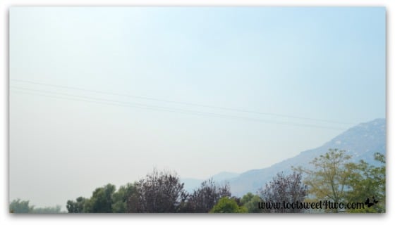
And, quite quickly, wildlife evacuated the area. The only birds who stayed behind were our swallows who remained faithfully in their 100+ nests built into the eaves of our house to guard and protect their eggs (or maybe their chicks – no chick sightings yet).
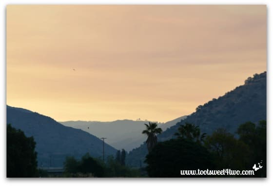
The next morning at 5:30 a.m., this was our eastern sunrise – a hazy yellow-orange smoke-filled glow (those specks are swallows flying).

And this was our western sky – a similar orange smoke-filled glow. Was the sun reflecting across the sky in our valley OR was this glow from the fires burning to our West?

Even the moon was quite visible in the western morning sky. We stayed put, not wanting to venture from our property – just in case. Just in case we, too, had to evacuate at some point. The reason for the early morning photos? I take a walk most mornings plus filled with anxiety, I didn’t sleep well. But, every morning on my walks, I have a constant visual reminder of October 22, 2007:
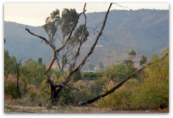
I call these trees our “Tim Burton skeleton trees”. They aren’t really ours, these charred remains of the 2007 Witch Fire. We have a dry river bed that runs behind our property, owned by the City of San Diego. This river bottom provided the fuel that directed the fire on its path west into the City of San Diego.
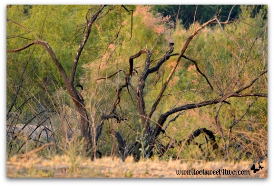
In 2007, it was a blackened ruin. Today, 5 and a half years later, new growth has sprouted around the charred remains. You see, the City never chopped them down or cleared them from the river bottom. The City lacked the resources for such an undertaking. So, they dot the path near the dry river and they run through the river bottom.
On Tuesday, I had to run an errand in town at lunchtime. So, anticipating that Tent City was still up in Kit Carson Park, I took my camera. In 2007, Kit Carson Park became the staging ground for the wildfires. A large park with easy access to a major inland freeway, it’s a logical choice for staging a massive, multi-city task force. At the moment, civilians aren’t allowed into the park, so most of these photos were taken from my car (don’t worry; I wasn’t driving! I pulled over!). They give you just a hint of the considerable resources brought in to fight the fires:
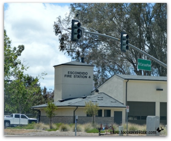
The fire station that sits on the edge of the park.
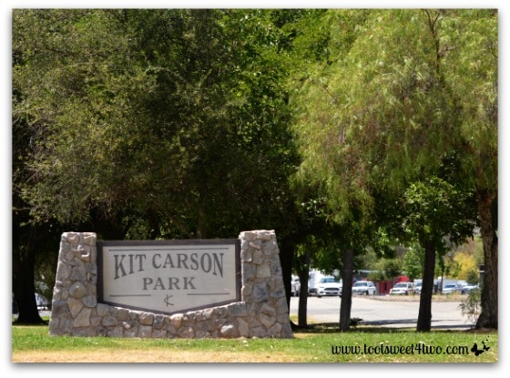
One of the entrances to Kit Carson Park – see the emergency vehicles parked along the road?
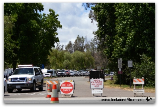
Another entrance to Kit Carson Park, filled with emergency vehicles and blocked off to civilian traffic.
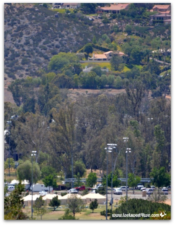
A view of a portion of “Tent City” from a hillside street taken with my telephoto lens (this is the best I could do – couldn’t find an unobstructed view of the park!).
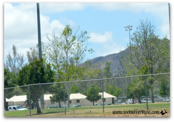
Street-level view of a portion of “Tent City” in Kit Carson Park.
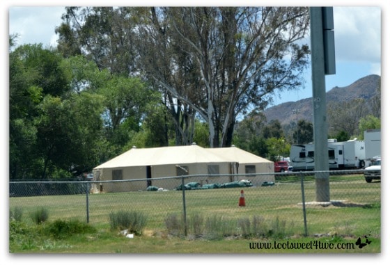
Close-up of one of the tents through the fence surrounding part of Kit Carson Park.
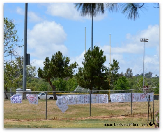
A “thank you” banner hanging on the fence at Kit Carson Park, probably done by students at one of the schools that border Kit Carson Park. I want to take a moment to thank firefighters, first responders and other emergency services personnel for the exemplary job they have done over the last 10 days. Even though they were unable to save my home in 2007 (18 firefighters tried and lost), I’m eternally grateful to them (read the story and you’ll find out why {grin}).
Back to the reason for this post – Alert: are you Ready?
As a result of both the 2003 and 2007 fires in San Diego County, our County has implemented an Alert system, also known as a reverse 9-1-1. If you sign up on their site, they will notified you via phone or text of any impending emergency evacuation in your area. If you are a resident of San Diego County, I encourage you to take advantage of this service. Click on this link: Alert San Diego. Do it now – it only takes a minute. I’ll wait.
That’s all I ask that you do this month. If you’ve fallen behind on the Resolve to Be Ready 2014 project or haven’t started this project, use the rest of the month to check off some of the boxes on the checklist. Every month, I update the ever-growing list of “to do’s” for this Resolve to be Ready series. That way, you don’t have to print out the list from the earlier posts – just print the most current list. Here’s the most current checklist: Resolve to Be Ready Project Checklist updated 5-22-2014.
If you are all caught up and want to jump ahead (kudos to you!), here’s the original Emergency Planning Checklist that I created in October 2007 that lists 12 separate projects to help you help yourself be more prepared: Emergency Planning Checklist.
While you can never be completely prepared for a disaster, anything you do today to plan for emergencies will make you less frazzled if and when the time comes…
Tootles,

Related Posts:
(all posts in the Any Way the Wind Blows series)
- Prologue – Any Way the Wind Blows
- Chapter 1 – The Valley That Time Forgot
- Chapter 2 – Eye of the Storm
- Chapter 3 – In the Blink of an Eye
- Chapter 3A – Too Far From Home
- Chapter 4 – Between a Rock and a Hard Place
- Chapter 5 – In a Blue Funk
- Chapter 6 – Back to Square One
- Chapter 7 – One Step Forward, Two Steps Back
- Chapter 8 – Not Me! Who Me? Why Me? It’s Me.
- Chapter 9 – The Whole Kit and Caboodle
- Chapter 10 – Feathering the Nest
- Chapter 11 – The Blind Leading the Blind
- Chapter 12 – Apple Pie Order
- Chapter 13 – All Hands on Deck
- Chapter 14 – In the Lap of Luxury
- Chapter 15 – Much of Muchness
- Chapter 16 – The Backup Plan
- Chapter 17 – What’s in Your First Aid Kit?
- Chapter 18 – Emergency Planning Checklist
- Chapter 19 – Counting Our Blessing
- Chapter 20 – Knockin’ on Heaven’s Door
(other posts about emergency planning and preparedness)
Leave a Reply